City Parks Foundation
|
|||
|
|
|||
|
From the lodown:
“The plan, which would replace faded bike lanes with a protected bikeway alongside Sara D. Roosevelt Park, is receiving consideration now because the bumpy street is scheduled for milling and paving, offering an opportunity to refresh its layout. “We are looking to resurface the road this year, so we will come back to the community once a design is put together,” DOT Manhattan Liaison Colleen Chattergoon said at the transportation committee meeting.”
Once the design is in from DOT, the community will view the results and weigh in. There are many seniors, housing for the deaf, children’s playgrounds, schools, etc. that will want to review the design to insure this works for elderly and youthful pedestrians, pedestrians with special needs, and bikers and cars and small businesses…
Read the article on the Stanton Street Building in SDR Park in the Lo-Down.
“Where the Parks Department sees a place to store stacks of pristine work gloves, rakes and other supplies, local activists envision a community center. Reconciling the two designs on a Stanton Street building within Sara D. Roosevelt Park remains as elusive now as 20 years ago….”
-story reported by Zach Williams.
Much thanks to the LoDown for their continued interest and thorough reporting in the park and it’s surroundings.
On February 25th, LES Ready: The Lower East Side Long Term Recovery Group will be hosting a town hall meeting to share findings and recommendations from a recent community-based research report. The report focuses on what worked well in the recovery effort following Hurricane Sandy, what could be improved, and documents the resources that CBOs in the Lower East Side had in place during Sandy, as well as their capacity to respond to future disasters. At the meeting, LES Ready will be distributing a newsprint that includes tips for disaster preparedness, and a map of where community resources can be found during disaster emergencies.
Date:
Wednesday, February 25th from 6-8pm
Grand Street Settlement, 80 Pitt Street.
Free! All are welcome!
For more information, please contact Lilah Mejia at lesreadyinfo@gmail.com.
“…local parks in some of the wealthiest parts of the city are doing very well.. .. the disinvestment in the parks system of the past years has not registered with many … Our marquee parks are doing better than ever, but we cannot let most parks fall behind while others thrive.
…we started the focus on parks equity nearly two years ago, it was clear that there was a limited understanding, and scant data, about the significant role conservancies play in our parks system. This bill would provide important information by requiring the Department of Parks & Recreation to gather regular information from conservancies that have contracts with the City on their total expenditures for maintenance and operation of their respective parks.
Beyond … transparency, Intro 384-A would also force stakeholders to truly understand the costs, and stark realities of government disinvestment, of current park operation. …
… Significant public dissemination and discussion of the information is critical, so it serves the goal of allowing the public, elected officials, parks advocates, and the conservancies themselves, to understand the impact different conservancies have, identify who is doing more with less, and help point to the most efficient and effective ways to improve parks throughout the system — those with conservancies and without…”
7:00 pm – 9:00 pm
January 6, 2015 – January 19, 2015
See amendments to the NYC Draft Action Plan and attend an upcoming public hearing for the chance to comment on BIG U (Manhattan) and Hunts Point Lifelines (Bronx).
January 15, 7:00 pm Educational Alliance, Manny Cantor Center 6th Floor, 197 East Broadway, Manhattan
January 19, 2015 – PUBLIC COMMENT PERIOD ENDS
Please join us and your fellow residents at these hearings and during the public comment period in January.
BIG (Bjarke Ingels Group) with One Architecture, Starr Whitehouse, James Lima Planning + Development, Project Projects, Green Shield Ecology, AEA Consulting, Level Agency for Infrastructure, Arcadis, and the Parsons School of Constructed Environments
The Big U is a protective system around Manhattan, driven by the needs and concerns of its communities. Stretching from West 57th street south to The Battery and up to East 42th street, the Big U protects 10 continuous miles of low-lying geography that comprise an incredibly dense, vibrant, and vulnerable urban area. The proposed system not only shields the city against floods and stormwater; it provides social and environmental benefits to the community, and an improved public realm.
The proposal consists of separate but coordinated plans for three contiguous regions of the waterfront and associated communities, regions dubbed compartments. Each compartment comprises a physically separate flood-protection zone, isolated from flooding in the other zones, but each equally a field for integrated social and community planning. The compartments work in concert to protect and enhance the city, but each compartment’s proposal is designed to stand on its own. Each compartment was designed in close consultation with the associated communities and many local, municipal, state and federal stakeholders; each has a benefit-cost ratio greater than one; and each is flexible, easily phasable, and can be integrated with in-progress developments along the City’s waterfront.
Bridging Berm provides robust vertical protection for the Lower East Side from future storm surge and rising sea levels. The Berm also offers pleasant, accessible routes into the park, with many unprogrammed spots for resting, socializing, and enjoying views of the park and river. Both berms and bridges are wide and planted with a diverse selection of salt tolerant trees, shrubs and perennials, providing a resilient urban habitat.
Between the Manhattan Bridge and Montgomery Street, deployable walls are attached to the underside of the FDR Drive, ready to flip down to prepare for flood events. Decorated by neighborhood artists, the panels when not in use create an inviting ceiling above the East River Esplanade. At night, lighting integrated into the panels transforms a currently menacing area into a safe destination. Panels can also be flipped down to protect from the elements, creating a seasonal market during the winter.
The east and west boundaries of the Battery were key inlets during Hurricane Sandy, allowing floodwaters to rush into Lower Manhattan and shut down the nation’s – and the world’s – premier financial district. Enhancing the public realm while protecting the Financial District and critical transportation infrastructure beyond, the Battery Berm weaves an elevated path through the park. Along this berm, a series of upland knolls form unique landscapes where people farm, sunbathe, eat and engage with world class gardens.
In place of the existing Coast Guard building, the plan envisions a new building programmed as a maritime museum or environmental education facility, whose form is derived from the flood protection at the water-facing ground floor. This signature building features a “Reverse Aquarium” which enables visitors to observe tidal variations and sea level rise while providing a flood barrier.
Download a PDF of the team’s final competition boards here.
View a PDF of the team’s full proposal here.
Read about highlights from the design process.
Review an earlier version of the proposal here.
Stakeholders
Asian Americans for Equality, Battery Park City Authority, Battery Park Conservancy, Brookfield Properties, Con Edison, Dermot, Downtown Alliance, Edison Properties, Empire State Development Corporation, Fire Department of New York, Friends of the High Line, Howard Hughes Corporation, Hudson River Park Trust, Lower East Side Ready (LTRG), Metropolitan Water Alliance, Metropolitan Transit Authority – City Transit / Bridges and Tunnels, Municipal Art Society, New York Rising, National Oceanic Atmospheric Administration (NOAA), New York Building Congress, New York State Department of Transportation, New York State Department of Environmental Conservation, New York State Office of Parks, Recreation & Historic Preservation, NYC Housing Authority, NYC City Council Districts 1,2,3,4, NYC Department of Citywide Administrative Services, NYCy Department of City Planning, NYC Department of Environmental Protection, NYC Department of Sanitation , NYC Department of Transportation, NYC Department of Education, NYC Landmarks Preservation Commission , NYC Manhattan Community Districts, NYC Mayor’s Office & Office of Long-Term Planning and Sustainability, NYC Parks Department, New York Police Department, New York State Senate Districts 26,26,28,31, New York State Assembly Districts 65,66,67,73,74,75, Port Authority of New York & New Jersey, Riverkeeper, Real Estate Board of New York, Regional Plan Association, Scenic Hudson, US Army Corps of Engineers, US Coast Guard, US Department of Homeland Security, US Department of the Interior – National Parks Service, US Department of Transportation, US Environmental Protection Agency, US General Services Administration, US Congressional Districts 8,12,14, 1,2,3,4,6
A plea from local bike activists:
Chrystie Street has a problem. The road is simply not safe enough for the thousands of daily users traversing it on two feet, two wheels, or behind the wheels of a vehicle. The last major change to Chrystie street happened more than six years ago, before Citibikes were a way of life and Vision Zero was the Mayor’s master plan for safer streets. Now in 2015, NYC’s Department of Transportation is looking to repave the roadway and so the time is right to re-examine the roadway and re-allocate space to better serve all those who use it. Join the conversation and help bring positive change to Chrystie Street.
Contact: Paco Abraham, dave.paco.abraham@gmail.com
Transportation & Public Safety / Environment Committee
Thursday, January 8 at 6:30pm — University Settlement at Houston Street Center – 273 Bowery
1. Approval of previous month’s minutes
2. Request for traffic control at Corlears Hook Park
3. Request for traffic safety measures on Clinton St at mid-block crossing
4. Informational presentation on the Chinatown Curbside Management Pilot Study Findings (click for info)
5. Presentation on Safety Concerns in the Chrystie Street Bike Lane
6. Consideration of state legislation to address the K2 legal/enforcement problems
7. Possible sites for relocation of 18 Allen St bus stop
BY GIDEON FINK SHAPIRO | DECEMBER 10, 2014
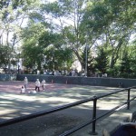
“This is Sara D. Roosevelt Park, a hard-working public space in Manhattan’s Lower East Side. Opened in 1934, it cuts a seven-block-long, roughly seven-acre swath through neighborhoods that have long been, and still are, home to a heterogeneous mix of communities….”
Read the full article in the link above.
|
|
|||
|