East Side Open House Jan. 31
From the Lo-Down (more details on the Lo-Down website):
“The MTA and the city’s Department of Transportation are kicking off a series of public meetings ahead of the L Train shutdown that’s scheduled to take place in the spring of 2019.
There are open houses on both sides of the Manhattan Bridge. The East Side session takes place Wed., Jan. 31 from 5-8 p.m. at the 14th Street Y, 344 East 14th St.“
Questions regarding the Shut Down of the L Train impact on the SDR Park community
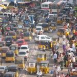
The plan to mitigate the transportation needs during the shut down of the L train would entail 70 Diesel buses an hour coming through our community across Delancey Street (and returning down Chrystie Street). This will increase pollution, bring unprecedented traffic down Chrystie/Delancey Streets alongside and through the park in a high-density area with children, seniors, deaf residents, blind gardeners, students, ball players, bikers, families, small businesses and workers.
We understand that this is a massive, unplanned and necessary shut down to fix the Sandy -damaged tunnel.
Here are our questions/concerns:
Street Congestion
- There are several buildings in various phases of planned/current construction on Chrystie Street where buses are planned to travel to get to the Williamsburg Bridge via Delancey Street. We see scenarios of backed up buses and traffic bringing yet more pollution and dangerous crossings here unless building on those construction sites are halted during the shut down. https://ny.curbed.com/maps/lower-east-side-apartments-development-boom-nyc
- Will congestion pricing help with this?
- Has there been any study of how existing bus traffic (both local MTA buses serving this community and the interstate bus stands) along and near Delancey and Chrystie Streets will be affected by this new influx (deluge?) of buses?
- Given that we have 4,000 cars per day using the Williamsburg Bridge is it time to demand the EZ Pass toll on this and other downtown bridges that are used as drive-throughs to and from NJ?
Health Affects of 70 Diesel Buses Per Hour on Adjacent/Nearby Corridors
- Is there data on asthma rates in these corridors? Heart disease rates? Lung cancer? Is there any data on any health risks that would be exacerbated by use of diesel buses
- http://a816-dohbesp.nyc.gov/IndicatorPublic/traffic/index.html
- https://ehjournal.biomedcentral.com/articles/10.1186/s12940-016-0172-6
- Why isn’t the city buying Electric buses which emit the equivalent of 650 grams per mile of greenhouse gas pollutants compared to 3,000 from a diesel bus and 2,800 from a compressed natural gas bus.
- Any data on the quantity of particulate emissions predicted by 70 Diesel buses per hour (each bus emits 40 toxic contaminants)?
- What would be the real cost of buying Electric buses vs health costs/risks and future costs to Medicaid for these corridors (not to mention the added burden to the global climate crises)? Especially given the current GOP tax cuts for corporations and losses to NYS funding streams.
- The Sierra Club’s analysis: https://www.sierraclub.org/compass/2017/05/no-more-small-pilots-it-s-time-rapidly-increase-electric-transit-buses
- Pollution effects on seniors: http://www.ehn.org/how-does-air-pollution-affect-elderly-2519387578.html
Vulnerable Populations/Pedestrian & Bike Safety:
- We have schools alongside SDR Park: Tenzer, Cascade, Satellite Academy, Pace HS, Emma Lazarus, IS 131, Great Oaks, along SDR Park on Forsyth Street.
- We have deaf housing on Forsyth Street.
- We have a senior center within the park on Delancey Street/Chrystie. And a senior daycare on Chrystie
- We have a large homeless population in SDR Park.
- We have a two-way bike lane that already endangers slower moving people (children/elders) with DOT refusing to install signage warning of pedestrian crossings on Stanton/Rivington/Broome/Hester. (and still waiting for DOT study results to install a speed bump requested by the deaf community on Forsyth Street).
- Children, families, school classes from nearby daycare, nursery, elementary school and after school programs use 3 playgrounds in SDR Park.
- Soccer fields/Handball court/Basketball courts are dedicated areas in SDR Park that are always in use.
- General quality of life decline.
- Access – A -Ride disruptions
The L train/Williamsburg Bridge Service Area
- Any data on how many people who use the L train work or shop in the Delancey/Chrystie neighborhood or use it to shop or work along the L train line?
- Any data on how many of the trucks/cars coming across the Williamsburg Bridge have these communities as their destination?
- What are the benefits to this neighborhood for enduring the 70 buses per hour, bad air, potential accidents and disruption to our communities?
Other Websites with information
The contribution of motor vehicle emissions to ambient fine particulate matter public health impacts in New York City: a health burden assessment
https://ehjournal.biomedcentral.com/articles/10.1186/s12940-016-0172-6
Asthma facts NYC:
http://www1.nyc.gov/assets/doh/downloads/pdf/asthma/facts.pdf
The Public Health impacts of PM2.5 from traffic air pollution
http://a816-dohbesp.nyc.gov/IndicatorPublic/traffic/index.html
Emissions Inventory System (EIS) Gateway
https://www.epa.gov/air-emissions-inventories/emissions-inventory-system-eis-gateway

