
Awaiting word, specific word with architectural drawings, engineering reports, concrete proposals now that word is out that the Administration wants to undo the years of Rebuild By Design efforts.
(The Rebuild by Design with the original plan website Here. More below)
“The de Blasio administration on Friday announced major changes to a 2.4-mile barrier designed to protect the Lower East Side from floods. The revision calls for jacking up portions of East River Park to protect it from storm surges and condensing the construction time line to ensure that the city qualifies for federal funding.
However, some stakeholders were puzzled that City Hall would announce such dramatic and costly changes so late in the process. The original plan had been hashed out over four years of community meetings and was already supposed to be traversing the public review process by the time several high-ranking de Blasio administration officials hastily convened a conference call last week to explain how the redesign protects the Lower East Side and facilitates access to the waterfront…”
“…The first section of the Big U, the East Side Coastal Resiliency Project, would stretch from East 25th Street south to Montgomery Street and use a series of walls, berms, levees and green spaces rising 16 feet above sea level to keep flood waters at bay. Superstorm Sandy’s storm surge in 2012 was 14 feet.
++++++++++++++++++++++
Original Big U Full Proposal Here:
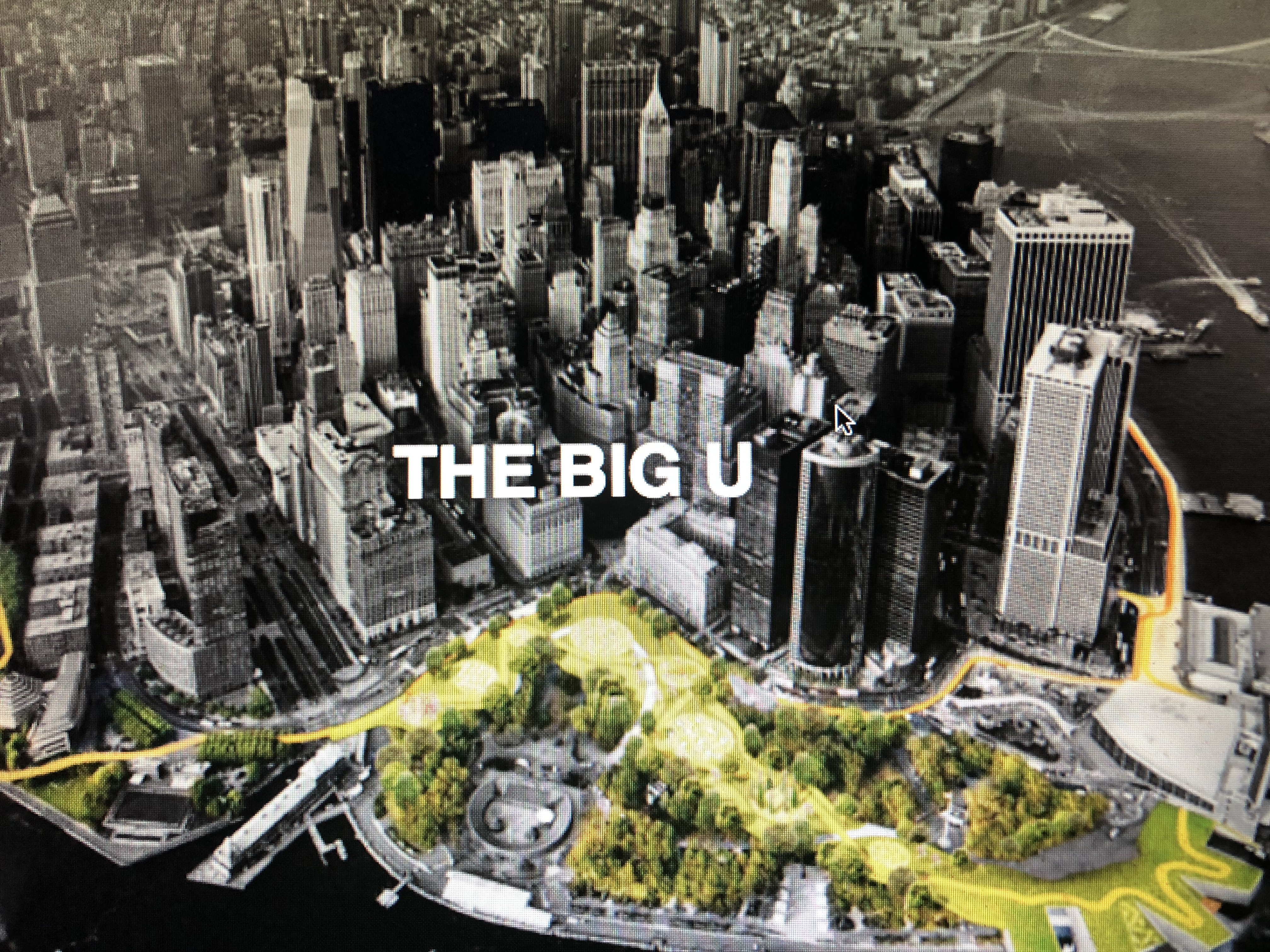
In collaboration with New York City, The BIG U proposal was developed to protect Lower Manhattan from floodwater, storms, and other impacts of a changing climate. The BIG U calls for a protective system around the low-lying topography of Manhattan beginning at West 57th Street, going down to The Battery, and then back up to East 42nd Street.
The proposal was conceived as 10 continuous miles of protection tailored to respond to individual neighborhood typology as well as community-desired amenities. The proposal breaks the area into compartments: East River Park; Two Bridges and Chinatown; and Brooklyn Bridge to The Battery. Like the hull of a ship, each can provide a flood-protection zone, providing separate opportunities for integrated social and community planning processes for each. Each compartment comprises a physically separate flood-protection zone, isolated from flooding in the other zones, but each equally a field for integrated social and community planning. The compartments work in concert to protect and enhance the city, but each compartment’s proposal is designed to stand on its own.
EAST RIVER PARK: A proposed Bridging Berm will both protect the area from storm surges and rising sea levels, and offer waterfront access for relaxation, socializing, and enjoying river vistas by providing pleasant, accessible routes over the highway into the park. Additionally, salt-tolerant trees and plants will provide a resilient urban habitat.
TWO BRIDGES AND CHINATOWN: Deployable walls attached to the underside of an elevated highway can flip down to mitigate flooding. Decorated by neighborhood artists, the panels will create an inviting ceiling when not in use, while integrated lighting will transform a currently menacing area into a safe community destination.
BROOKLYN BRIDGE TO THE BATTERY: The Battery Berm weaves an elevated path with a series of upland knolls to form unique landscapes. The plan envisions transforming the existing Coast Guard building into a new maritime museum or environmental education facility featuring a “Reverse Aquarium” where visitors can observe tidal variations and sea level rise.
Progress on Implementation
HUD has dedicated a total of $511 million, including Rebuild by Design and National Disaster Resilience Competition funding, toward the implementation of The BIG U, and New York City has committed an additional $305 million in capital funding to start the first phases of the East Side Coastal Resiliency (ESCR), and Lower Manhattan Coastal Resiliency (LMCR) projects. The proposal breaks the area into sections, known as compartments: East River Park; Two Bridges and Chinatown; and Brooklyn Bridge to The Battery. For implementation the project has been broken into the original three components. The East River Park Component is being implemented as the ESCR, and from Montgomery Street to the Battery is the LMCR project. LMCR is being implemented in two separate parts.